Settlement & Landscape Archaeology

Tracing Lives Beyond the Ruins

Popular accounts love the phrase "lost city," yet rarely were these places lost to the descendant communities living around them. What disappeared from outside memory was often a whole regional way of organizing farms, roads, drainage canals, and civic plazas.

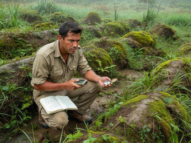
Field archaeologist taking compass and GPS bearings across vegetated earthen terrace mounds in humid daylight
Ground-truthing remote elevation models: test pits recover domestic pottery, grinding stones, and charred maize phytoliths that confirm lived households.
Upano Valley, Sangay Foothills, Ecuador c. 500 BCE – 600 CE

Agrarian Cities Beneath the Amazon Canopy

For much of the twentieth century, environmental determinists argued that acidic tropical soils in Amazonia could never sustain dense, permanent pre-Columbian towns. Beginning in the 1990s, archaeologist Stéphen Rostain and Ecuadorian colleagues excavated earthen mounds at Kilamope and Sangay, recovering painted ceramics, postholes, hearths, and large jars holding residue from maize beer (chicha).

In 2015, Ecuador's National Institute for Cultural Heritage commissioned an airborne LiDAR survey across 300 square kilometres of the Upano River basin. Published in 2024, the resulting bare-earth terrain map revealed over 6,000 rectangular earthen platforms arranged around low plazas across at least fifteen distinct settlements. Straight, excavated roadways up to 10 metres wide stretched for 10 to 20 kilometres between centres, flanked by drainage ditches that managed intense Andean foothill rainfall.

Crucially, the empty spaces between platform clusters were not wilderness: they were gridded into drained agricultural fields growing maize, beans, sweet potato, and manioc on fertile volcanic ash from nearby Sangay Volcano. Archaeologists describe this pattern—seen also in Casarabe mounds in Bolivia and Classic Maya lowlands—as "low-density agrarian urbanism."

Stratified domestic floors on 20-by-10-metre earthen platforms, fire pits, storage jars, starch grains of Zea mays, radiocarbon dates spanning roughly a millennium by Kilamope and Upano cultural phases, and volcanic tephra horizons.

Andean Late Archaic

Caral-Supe and the Maritime-Valley Exchange

Located 200 kilometres north of Lima in an arid valley fed by seasonal Andean runoff, Caral looked to mid-twentieth-century travellers like natural eroded hills. Because surface surveys turned up zero fired pottery fragments, researchers assumed the mounds were late or minor.

When Peruvian archaeologist Ruth Shady Solís launched systematic excavations in 1994 and dated woven reed carrying-bags (shicra) filled with river cobbles inside the Pirámide Mayor, radiocarbon labs returned startling dates between 3000 and 1800 BCE. Caral is the oldest known urban centre in the Americas, thriving for over a thousand years before ceramic vessels became routine in the Andes.

How did an inland desert valley sustain six platform pyramids, sunken circular amphitheatres, residential compounds, and workshops producing bone flutes carved from pelican and condor bones? Excavations along the Pacific coast at Áspero provided the material link. Valley farmers cultivated cotton (Gossypium barbadense) and bottle gourds—not primarily for food, but for fishing nets and floats. Coastal crews used those nets to harvest vast shoals of anchoveta and sardines, sending dried protein inland in exchange for cotton fibre and squash. Notably, Caral lacks defensive perimeter walls, burnt destruction layers, or skeletal trauma typical of organised warfare.

Southern African Plateau & Harappan Comparison

Civic Infrastructure Without Royal Monuments Alone

Great Zimbabwe, Masvingo c. 1000–1450 CE

Water Storage & Dry-Stone Mastery

Colonial-era writers once fabricated foreign origins for Great Zimbabwe's 11-metre-high Great Enclosure walls, ignoring unequivocal stratigraphy studied by Gertrude Caton-Thompson in 1929 and generations of Zimbabwean archaeologists since, including Innocent Pikirayi and Shadreck Chirikure. Built by Shona ancestors from heat-split granite courses without mortar, the 720-hectare town integrated elite enclosures, earthen dhaka houses, iron and gold smelting furnaces, and Swahili-coast trade goods such as Chinese celadon and Persian glazed ware. Recent LiDAR and soil studies published in 2023 demonstrated that large depressions called dhaka pits—dug to quarry clay for houses—were engineered along natural springs to act as year-round water reservoirs during dry seasons.

Mohenjo-daro & Dholavira, Indus Basin c. 2600–1900 BCE

Sanitation, Weights & Non-Palatial Governance

Across more than a thousand Harappan settlements in present-day Pakistan and northwestern India, excavators find standardised baked-brick ratios (1:2:4), cubical chert weights accurate across hundreds of kilometres, covered street drains, brick-lined wells in private homes, and rock-cut storm reservoirs at Dholavira. What remains strikingly absent are colossal royal tombs, boastful military stelae, or unmistakable kingly palaces. How civic standards were maintained across an area larger than Mesopotamia and Egypt combined—whether through merchant guilds, kinship councils, or rotating ritual authorities—remains one of urban history's richest open debates.

Continue to Ancient Structures →